Tuyen Quang: Explore Na Hang, The Wild Fairyland Of The Northeast Vietnam
When we talk about tourism in the Northern mountain of Vietnam, people will think about famous places such as Moc Chau, Ha Giang, or Lao Cai. However, there is one destination that is less known to the public but is worth discovering for its alluring wild beauty and unique culture, which is Tuyen Quang. Specifically, a place in Tuyen Quang is considered an ideal paradise for you to explore during your trip, but not many people know about it. That is Ha Nang.
Na Hang is the name of a district in Tuyen Quang, but it is located farthest from the city center compared to the rest of the districts, which is longer than 100km. Basically, Na Hang is considered a highland district, but out of a total area of 15,000 ha, there is 8,000 ha of water surface here. Therefore, visitors when coming to Na Hang will be able to see the charming scenery of the mountains and water and discover the cultural characteristics of the 12 ethnic groups living in this place.
What's in the wild fairyland of the Northeast of Vietnam?
 |
| Photo: Bao Dan Toc |
Many adventurers and tourists have named this destination “the wild fairyland of the Northeast of Vietnam." There are several reasons for this. The first is because the geographical location is somewhat remote from the city center. The second is the beautiful natural scenery. And finally, according to visitors, there is no Internet or phone signal here, which will make you feel like you are separated from the outside world.
Coming to Na Hang, tourists can choose from many unique places to visit and experience, such as Pac Ta mountain, Coc Vai mountain, Fairy cliff, Ngam Nui Doi, Khuoi Nhi waterfall, or the valleys of pear flowers, plum flowers blooming white in the mountains. Another very famous experience you can participate in Na Hang is paragliding. Paragliding is popular in the Hong Thai commune in the district, and there is a festival hosted here every year called Hong Thai paragliding festival.
Pac Ta mountain
 |
| Photo: Toquoc.vn |
If Quan Ba has the symbol of a Double mountain, you will be astonished at the marvelous scenery of Pac Ta mountain in Na Hang, which is considered a famous symbol of this land. The mountain is located next to Na Hang-Lam Binh ecological lake, creating an incredibly charming scene.
The mountain is also known as elephant mountain because, from some angles, its shape looks like a giant elephant under the blue sky.
To fully enjoy the beauty of Pac Ta mountain, visitors can choose to walk around the ecological lake area, row a boat on the lake, or visit the Pac Ta temple right at the foot of the mountain. The local people come to this temple to worship the fiancee of General Chieu Van Vuong - Tran Nhat Duat. After many changes of location and restoration, in 2008, the temple was rebuilt here, and in 2009, it was classified as a National Monument by the Ministry of Culture, Sports and Tourism.
 |
| Photo: Toquoc.vn |
Mo Waterfall
Mo Waterfall is located between the National Scenic Area Na Hang - Lam Binh Nature Reserve. The waterfall is about 2km long, the highest floor is about 20m. As described by many tourists, from afar, the waterfall looks like soft, white silk flowing down the Na Hang ecological lake.
According to the information page of Tuyen Quang Province Tourism, the waterfall is also associated with the legend of a woman waiting for her husband. Every year, Mo waterfall welcomes thousands of tourists to visit and admire the extraordinary beauty of the place.
 |
| Photo: toquoc.vn |
Hong Thai terraced field
In Na Hang, a very beautiful place to see terraced fields is the Hong Thai commune. Because of this, the rice season here has become one of the unique tourist sites and improved life for the local people here.
Hong Thai commune currently has a total area of 82 hectares of terraced rice fields, stretching over many villages and along inter-commune roads. The terraced fields are usually very narrow, but each hill usually has about 10 to 20 fields, in some places up to more than 30 steps, the average height of each plot is from 1.5m - 2m. Due to the high mountains, the fields are surrounded by forests, at the junction between the two hills, there are often flowing streams, which is the main source of water for the crops.
 |
| Photo: Toquoc.vn |
 | Vietnam Voted As The Best Culinary Destination in Asia By Travel + Leisure Recently, the US travel website Travel and Leisure has honored Vietnam as the destination with the most culinary culture in Asia in the Bucket List ... |
 | Vietnamese Photographers Captures the Magic of the Mekong via Photography When the Tet holiday comes close, the farmers in the Mekong River Delta are busy taking care of the beautiful and colorful flower gardens to ... |
 | Enjoy a Peaceful Spring Trip to the Sacred Land of Tay Ninh From a sacred and almost secluded land, Tay Ninh has become the best destination to visit in the Southeast Region of Vietnam thanks to its ... |
Related Stories
 Travel
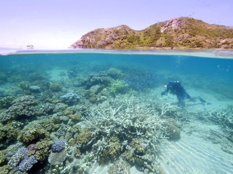
Top Coral Reef Diving Destinations in Viet Nam for Summer 2026
 National
Vietnam News Today (July 12): Vietnam Ready to Share Digital Transformation Experience with Timor-Leste
Recommended
 Travel
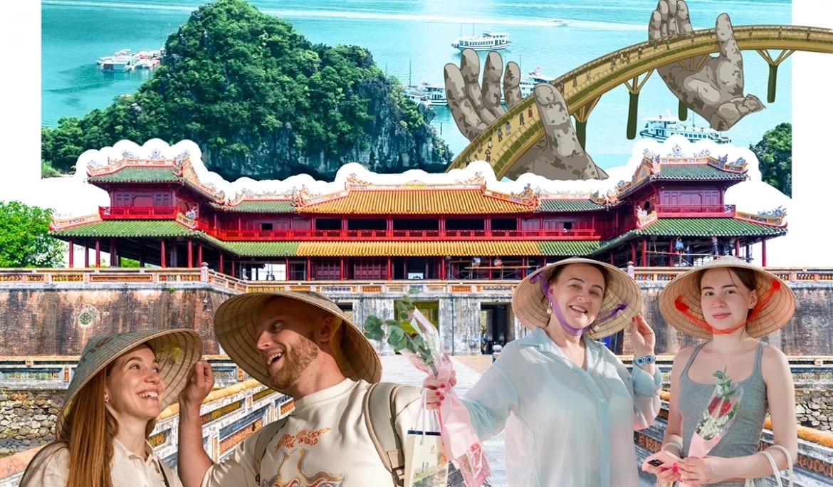
"Discover Moscow" - Tourism Information Ecosystem Launches Vietnamese Version Platform
 Travel
Leveraging Cuisine to Elevate Vietnam's Tourism Brand
 Travel
Ho Chi Minh City Boosts Tourism Revenue Through High-Value Visitor Strategy
 Travel
Vietnam Ranks First in Number of Foreigners with Long-Term Stays in RoK
 Travel
Bringing Essence of Vietnamese Cuisine Closer to Europe and the World
 Travel
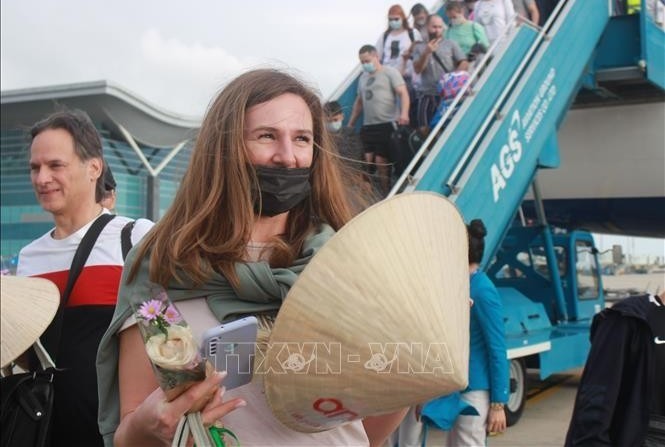
Russian Arrivals to Vietnam Nearly Triple in First Half of 2026
 Travel
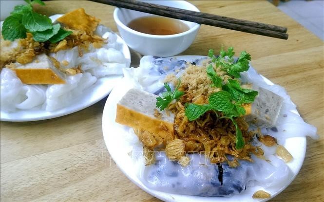
French Magazine Highlights Must-Try Dishes of Vietnam Cuisine
 Travel