UK and Europe weather forecast latest, December 4: Ferocious chill with five day snow bomb to hit Britain


UK's weather forecast
A freezing cold front is making its way down the west of the UK from the North Atlantic, according to the latest snow probability models from WXCHARTS. The weather charts show Scotland is expected to bear the brunt of the wintry blast as the charts turn a deep shade of red from Wednesday until Friday morning, suggesting there is 90 percent chance of snow. Soon after the charts turn deep blue and purple - meaning there may be 40 to 60 percent chance of snow - over western parts of Scotland including Ayreshire and Loch Lomond across a five day period until Monday.
Regions as far south as Bournemouth turn blue during this period, while also covering Birmingham, Manchester and Liverpool along the way.
On Monday, the charts turn a faded blue, meaning there is only a small 10 percent chance of snow. Temperatures are also forecast to plummet to bitterly cold lows of -4C in western Scotland and -3C in Liverpool on Thursday evening, weather maps by WXCHARTS suggest.
 |
| UK snow map: A cold front is forecast to push over the UK (Image: WXCHARTS) |
Netweather's Paul Michaelwaite said cold weather will "stick around...into the weekend". He said: "This evening, the showers will continue in the west with snow starting to accumulate up over the hills of Scotland, Northern England and Wales. Where skies clear across Scotland and Northern England, it'll be a cold night with a hard frost forming in places. Further south, with more cloud, it'll stay milder."
"Into Thursday and with low pressure both to the north and south of the UK, it's fair to say it'll be a messy, unsettled kind of day. The showers, which will have started the day most affecting the west and north will quickly spread east through England and Wales."
"They'll be wintry over the hills in particular, with rain mostly falling lower down, but in the heavier bursts and into the evening some sleetiness or wet snow is possible to lower levels as well. As the southern low becomes the dominant player during the day."
Mr Michaelwaite added snow could hit some regions over the weekend. He said: "Looking ahead to the end of the week, and into the weekend. We'll keep low pressure overhead or nearby, so there'll be further spells of showery rain, sleet and snow. With colder air in situ, we'll also see temperatures fall away quickly during clearer spells, with frost and ice forming."
 |
| UK snow map: Cold air will sweep over from the Atlantic (Image: WXCHARTS) |
BBC Weather's forecast for this week said snow may linger until Monday as low pressure moves in. The forecast said: "On Wednesday a weak frontal system moves south east across the UK, bringing rain and then colder air. This front will be followed by a deepening low pressure system stalling over the UK between Thursday and Saturday. This will bring rather miserable weather on Thursday, grey and wet with rain for all areas as well as increasing winds, peaking in strength on Friday when there will be an uncomfortable wind chill."
"There is the risk of hail showers for western regions, especially Northern Ireland, Wales and southwest England, while the best chance of any sunshine on Friday will be across Wales and southern and western counties of England. It will become cold enough Thursday to Saturday for some snow to get mixed in, especially over northern and western hills but possibly to lower levels in Scotland at times. Some sleet or wet snow cannot be ruled out further south but looks unlikely to be disruptive."
"By Sunday morning the low pressure system should be moving away southwards, leaving drier, sunnier, calmer but cold conditions. Frost, ice and fog patches on Sunday night. A few wintry showers will still be possible, especially for Northern Ireland and across northern and western areas of Scotland, Wales and England."
 |
| UK snow map: Snow could linger until the weekend (Image: WXCHARTS) |
"Monday will see a new area of low pressure moving in from the east, introducing extensive cloud cover to northern, central and eastern areas with showers or longer spells of rain, sleet and hill snow moving west. Most snow of any consequence will be over the Pennines, Peak District and eventually southern Scotland."
The Met Office has issued weather warnings for snow and ice from today until Friday at midday. Areas affected are the highlands of Scotland, as well as more southern parts of the country, including Pert and Edinburgh.
The Met Office also warned of 10cm snow falling in some parts of western Scotland. The warning said: "Frequent showers will increasingly turn to snow Wednesday night and persist into Thursday morning though these likely to fall as sleet and hail at times, mainly around coasts.
"Northwest Scotland looks most exposed to these showers with 2cm of snow accumulating by Thursday morning in places even to low levels. Larger accumulations are expected at higher elevations with 2-5 cm above 200m and up to 10cm over some of the highest routes."
"Snow is expected to arrive from the east overnight Thursday into Friday. Early on Friday morning, this may briefly settle across areas as low as 100m above sea level, although through the morning the accumulating snow level is likely to rise to 500m and above as milder air arrives from the east."
 |
| UK snow map: Temperatures could plunge to -4C (Image: WXCHARTS) |
"Snow will then turn to persistent and at times heavy rain at lower levels. 2-5cm of snow is possible above 150m, with transient sleet/snow at lower elevations. Steadily increasing amounts are likely at higher levels; perhaps as much as 15-20cm above 400m, significantly affecting higher transport routes for a time before it turns to rain."
On December 4
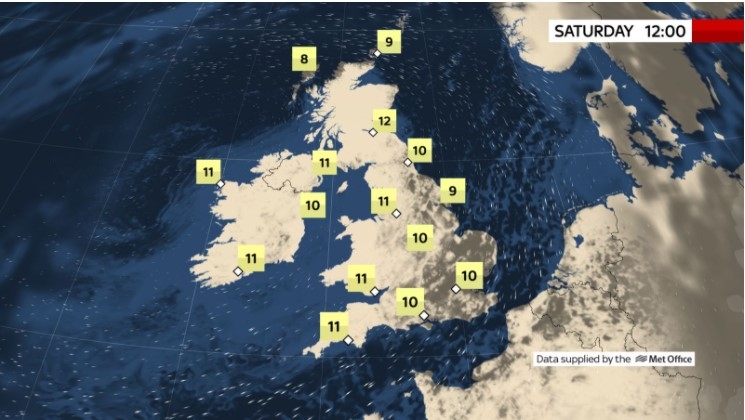
According to Weather Online, low pressure dominates through Friday, centred over eastern parts of the UK. There will be areas of rain rotating around the low, mostly afecting eastern England and eastern Scotland. Here the rain will be falling as snow over high ground and rain could be heavy at times. Further rain in northern and western Wales as well as northern coasts of Cornwall and Devon. Perhaps drier in central and southern England, some bright spells here. Cold and dry in Ireland with good spells of sunshine, although some showers over western coasts. Tops at 3 to 6C.
Europe's weather forecast
Rain in northern Spain and turning colder here. Fair for the rest of Spain and Portugal. A fine day to come through the Balearic Islands, but some showers in Corsica and Sardinia. Heavy rain affects southern Italy whilst the north stays dry. Greece will be largely dry with some sunny spells although there will be some rain in the southern Peloponnese. Turkey is going to be largely dry too although rain afecting southern coasts.
 |
| Photo: Stirimeteo |
Blustery rain in much of northern and western France, some of this heavy. Eastern and southern areas will see a few showers. A band of showery rain passes through the Low Countries into western parts of Germany, but the rest of Germany should be dry. Showers in western Poland but dry in the east. Rain for Hungary and southern Austria, dry in Switzerland.
 |
| Photo: Stirimeteo |
Breezy for Denmark but mostly dry. Breezy through Swede, again dry here. A windy day in the Baltic States and Finland and staying dry. Breezy with further period sof rain affecting much of Norway as well as Denmark.
On December 4
According to Weather Online, cold across Spain and Portugal with rain and showers, these heavy at times. Further showers and rain in the Balearics and cold weather here too. Heavy rain in northern Spain and across Corsica and Sardinia. Southern Italy should be brighter and drier. Showers around Greece, with heavy showers in western and southern Turkey.
Rain and showers in France and cold here too. Further rain in the Low Countries. Germany should be mostly dry with some patchy rain and strong winds in Poland. Hungary will be dry with some sunny spells. Austria and Switzerland have more cloud and some outbreaks of rain.
 |
| Photo: Weather Online |
Denmark will be dry and bright, sunny spells. The Baltic States will be windy as well be Finland. Rain in the west of Finland. More rain in central and northern Sweden. Norway will be bright with sunny spells and should be dry.
 | UK and Europe weather forecast latest, November 30: 10 cm of snow threatens to freeze the continent Freezing temperature is forecast to strike the UK in 11 days expected. Meanwhile, Europe sets to bear 10 cm of snow threatening to freeze the ... |
 | UK and Europe weather forecast latest, November 29: Severe weather with dense icy fog lingers Britain is forecasted to cope with severe weather accompanied by dense icy fog disrupting visibility. Meanwhile, snowfall and cold air set to cover across Europe. |
 | UK and Europe weather forecast latest, November 28: Icy temperatures with heavy snowfall to cover Britain The UK and Europe is facing with icy temperatures with heavy snowfall in some parts of the former and wintry storms expected in the latter. |
Related Stories
 World
World
Europe Faces Historic Heatwave, More Than 1,000 Deaths Reported
 National
Vietnam News Today (Jun. 18): Vietnam, Argentina Look to Stronger Comprehensive Partnership
Recommended
 World
World
Vietnam Reaffirms Support for Effective Implementation of ASEAN's Five-Point Consensus
 World
World
Algeria Shares Healthcare Expertise to Advance Africa's Pharmaceutical Self-Reliance
 World
World
Modi's Asia-Pacific tour highlights India's regional engagement
 World
World
Australia-India Partnership on Cyber, Critical Technologies and Supply Chains
 World
World
Venezuela Declares Seven Days of National Mourning for Earthquake Victims
 World
World
Myanmar Destroys Over 50 Tons of Drugs on International Anti-Drug Day
 World
World
French Adventurer to Cycle 19,000 km to Vietnam, Taking on 14 of Asia and Europe's Highest Passes
 World
World