Mapping risk of UXO at A Luoi district, Thua Thien Hue province

 |
| The maps of Project result were directly handed over to the district and communes. Source: NPA Vietnam |
Norwegian People's Aid (NPA) Vietnam and Vietnam National Mine Action Center (VNMAC) just organized a meeting to close the phase III of VNMAC Technical Survey Project in A Luoi District, Thua Thien Hue Province.
In addition to NPA and VNMAC staff, participating in this event were representatives from different beneficiary communes, the District Military Command and the District People's Committee.
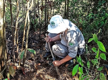
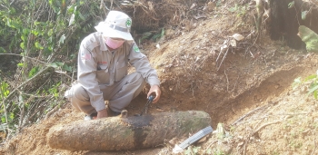
Technical surveying (TS), a task where Technical Survey procedures are used to determine parts of the area with a non-known threat to define the area to a Confirmed Hazardous Areas (CHA).
Before announcing the closing of the TS project, Nguyen Duc Thanh, VNMAC TS Project Site Manager, made the presentation to participants on the results of the project and he also shared the potential plan for the future clearance work in A Luoi district, in the time to come.
Magnus Johansson, NPA Senior Technical Field Manager, as the co-implementing partners for this project and on behalf of the donor, expressed the congratulation to VNMAC for the successful operations and presented NPA sincere thanks to local authorities for the great support over the project implementation, in the very effective tri-partnership model among NPA, VNMAC and the A Luoi District Military Command (DMC).
On behalf of beneficiaries, the district and commune leaders show their appreciation to the TS project efforts and would hope for the clearance soon to be planned and conducted in the coming time so as local people can eventually have safe land for cultivation and live-hood assurance.
The maps of Project result were directly handed over to the district and communes and the digital version of data and maps will be delivered soon once the detailed data analysis is completed.
 |
| NPA’s Battle Area Clearance (BAC) has been working in Son Qua Village of Phong Son Commune, Phong Dien District, Thua Thien Hue Province for six months with the task to clear a confirmed hazardous area previously defined during the NPA’s technical survey process. |
The VNMAC Technical Survey Project is the joint project between VNMAC and NPA Vietnam, with local cooperation of A Luoi DMC, funded by the US Department of State's Bureau of Political-Military Affairs (PM/WRA). The main project goal was to conduct an efficient and cost effective land release approach in eight Communes in A Luoi District of Thua Thien Hue Province utilizing non-technical and technical survey, and to report it to the national database.
Following 13 months of work, the project has completed 17 TS tasks, with over 9 million square meters surveyed, resulted in 10 CHAs, and over 16 million square meters defined as CHA. This final result was exceeding the project target of six million square meters CHA, thanks to the hard works of the teams and supportive cooperation from the province.
The wars in Vietnam have ended for a long time, but the amount of post-war unexploded ordnance (UXO) has been extremely large, contaminating about 6.13 million hectares of land, accounting for 18.71% national land area, posing a threat to the people’s life, and directly impacting on social security and the country’s development.
Between 1945 and 1975, the volume of bombs, mines, and ordnance used by foreign countries in the wars in Vietnam was 15 million tons, 4 times as many as in the World War II.
Thua Thien - Hue is one of the provinces with highest level of landmines contamination in the country, with more than 170,400ha (accounting for 35% of the province's total area).
About 70km to the west of Hue city, A Luoi mountainous district is located on the Ho Chi Minh trail which served as an important artery for the Northern Vietnamese Army to transport weapons and personnel during the war. As a result, A Luoi was heavily bombed and shelled./.
 | Ru Cha mangrove forest in the changing moments of seasons In early September, the green leaves turn yellow in the Ru Cha (Hue) mangrove forest, creating an impressive seasonal change picture. |
 | Nearly 100 cluster munitions found in Thua Thien Hue Norwegian People’s Aid (NPA)’s team recently safely destroyed nearly 100 cluster munitions found by local farmer in A Luoi district, Thua Thien Hue province. |
 | UXOs clearance continues in Vietnam despite pandemic More than 45 years after the war ended in Vietnam, many residents of Thua Thien Hue province still encounter many items of Explosive Ordnance (EO) ... |


Most read

Related Stories
 Friendship
Friends of Project RENEW Continues Supporting War Consequence Remediation Efforts in Viet Nam
 Viet's Home
Zhi Shan Foundation Awards 248 Scholarships and Establishes Three Libraries for Students in Hue
 National
Vietnam News Today (Feb. 25): Tet Tourism Season Sees Strong Nationwide Growth
 Friendship
UN Under-Secretary-General for Peace Operations Speaks Highly of Vietnam's UXO Clearance Efforts
Recommended
 Friendship
Da Nang Promotes Connections with Localities and Businesses in Chile
 Friendship
Vietnam Receives 14 Remains of Volunteer Soldiers and Experts from Cambodia
 Friendship
Thanh Hoa and Saint Petersburg (Russia) Strengthen Cooperation
 Friendship
Vietnam and Timor-Leste Promote Cooperation
Popular article
 Focus
Focus
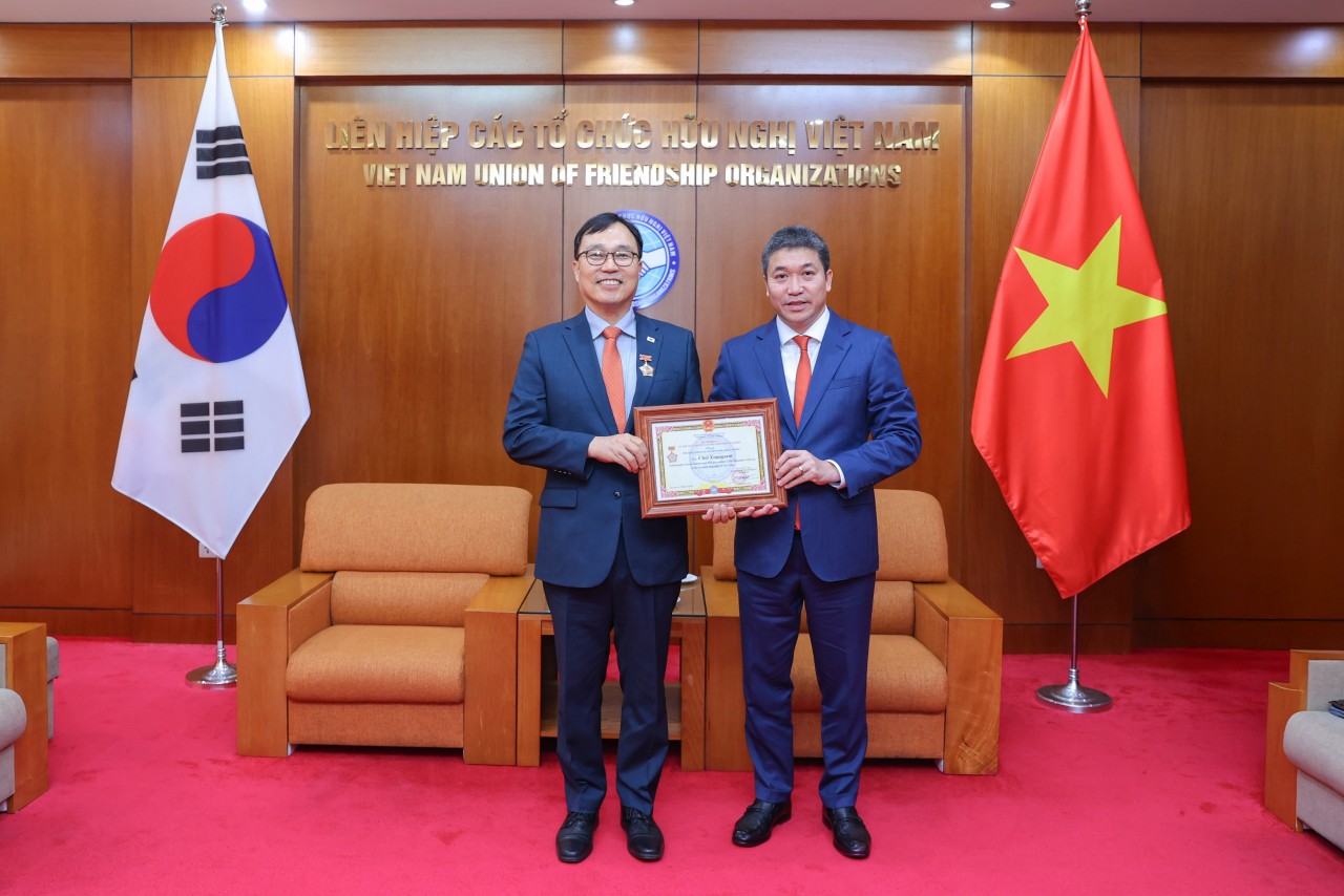
Ambassador Choi Young Sam Awarded “For Peace and Friendship Among Nations” Medal
 Friendship
Vietnam, Algeria Strengthen Traditional Ties
 Friendship
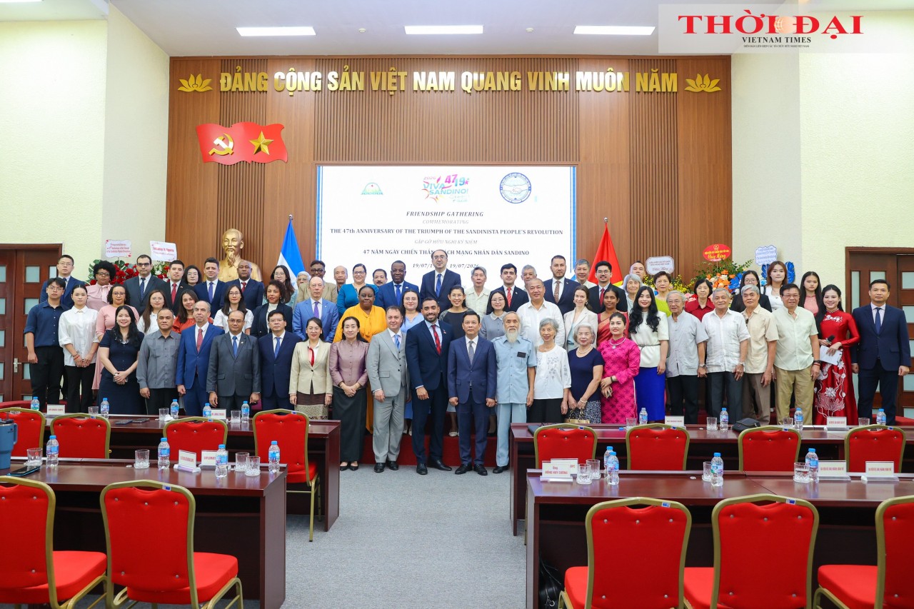
Commemorating 47th Anniversary of Triumph of Sandinista People's Revolution: Expanding Vietnam-Nicaragua People-to-People Exchanges
 Friendship